What is FME?
FME (the Feature Manipulation Engine) is a data integration tool used for transforming data.
History
Safe Software began in a basement in 1993, helping forestry companies exchange maps with the provincial government. Sure, it was technically possible to share the maps back then, but only after hours fighting with the data. Often, an incredible amount of information was lost in the process.
In short, nobody was happy. We built FME to change that.
We didn't start with a business plan, but we did have a desire to help. Our passion for freeing data was ignited, and we've been on a mission to help people experience that freedom ever since. We're continuing to expand what’s possible with FME, the data integration software with the best spatial support in the world.
Extract, Transform, and Load (these sections to be updated according to new marketing language)
FME accomplishes data integration through a popular technique called ETL. ETL stands for Extract, Transform and Load. It is a data warehousing technique that extracts data from multiple sources (here A and B), transforms it to fit the users’ needs, and loads it into a destination (C):
While most ETL tools process only spreadsheet (i.e., tabular) data, FME also has the processing capabilities required to handle spatial data. It also uses a graphical interface, so no coding is required.
How FME Works
At the heart of FME is an engine that supports an array of data types and formats: Excel, CSV, XML, and databases, as well as various types of mapping formats including GIS, CAD, BIM, and many more.
The capability to support so many data types is made possible by a rich data model that handles all possible geometry and attribute types.
Who Uses FME?
FME has helped thousands of customers worldwide leverage their data so it can be used exactly where, when, and how it’s needed. Many of our customers are in the following industries:
- Architecture & Engineering
- Federal Government
- Local Government
- Oil & Gas
- Telecommunications
- Utilities
Here are a few examples of how people use FME, with links to more details.
Vancouver International Airport
The Vancouver International Airport (YVR) wanted to provide passengers with indoor mapping data via their mobile app. To get to the airport from your home, you can use Google Maps to obtain driving directions or transit options, but what about once you get to the airport? How are you going to locate and get to your check-in counter and the appropriate security gate? After security, how are you going to find the nearest water fountain or café? Mapping the interior of buildings, or indoor mapping, is increasingly important to organizations who want to help their customers navigate inside spaces. YVR is one of the first airports to provide its indoor mapping data to Apple Maps, and its GIS team has proven their innovation by offering a variety of ways to navigate the public indoor spaces of the airport using digital technology. All of this is made possible by using FME.
Optional: watch a video about this example.
Optional: watch a presentation about this example.
The Weather Network or Pelmorex Corp.
The Weather Network or Pelmorex Corp. used FME to create the Pelmorex Lightning Detection Network (PLDN). With FME Server’s data streaming and data download services, lightning strike data from their sensors all over Canada is restructured. It is then made accessible via Google Earth™, an ArcGIS® Flex™ Viewer, email alerts, and more. This network required only three weeks to set up and runs automatically. Both real-time and archived strike data is immediately accessible for critical decision-making by Pelmorex clients, including insurance companies, government agencies, transportation companies, and public utilities.
Optional: read a blog post about this example.
Tetrad Sitewise
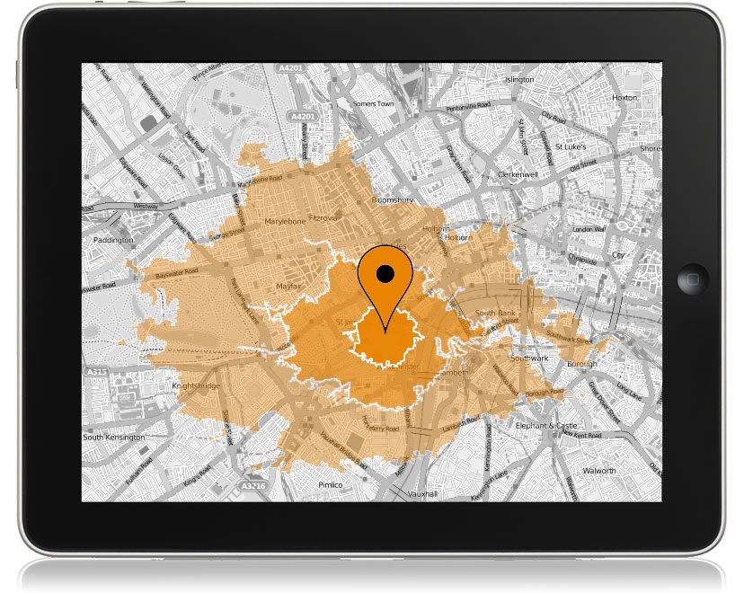
Tetrad provides market analysis solutions to help their clients select sites for new business locations. They provide Sitewise software using FME. Using FME, Sitewise can analyze competition, parking, transit accessibility, combining multiple datasets to make an educated assessment. Using FME, Sitewise provides custom tools to show their clients where their customers are traveling from, generate their trade area profile, and calculate market penetration by neighborhood.
Optional: watch a webinar about this example.
Visit our website for more customer stories.
Data Integration Platform
This module covers using FME Desktop for data translations and transformations at the desktop level. FME Desktop is one piece of software in the FME data integration platform:
- FME Desktop lets you connect and transform data.
- For example, taking an Excel spreadsheet of business information and addresses and adding it to a MySQL database that is the backend to a citizen data access portal that allows searching for business license information.
- FME Server provides enterprise-level automation.
- For example, allowing business licensing officers working for a city government to add new business licenses to the database in real time by sending an email or filling out a web form.
- FME Cloud is the hosted version of FME Server in the cloud.
- For example, the server that carries out the operation above could be hosted in the cloud, rather than directly by the City.


